In Dallas, a Fight Over the Land Between the Levees
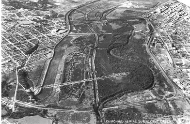
An aerial photograph from the late 1920s showing the channelization of the Trinity River through Dallas. The original river channel is on the right, meandering right by downtown Dallas in the far upper right. Much of the old river channel is now buried, or serves as a run-off ditch.
Credit: Courtesy of Dallas/Texas Historical Archives, Dallas Public Library