In Dallas, a Fight Over the Land Between the Levees
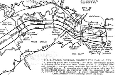
This schematic drawing from the 1930s shows the Trinity flood control project. The dark dashes show the boundaries of a major flood in 1908 that prompted the city to dig a new channel for the river and wall it off behind levees.
Credit: Courtesy of Dallas/Texas Historical Archives, Dallas Public Library